Cache la Poudre River National Heritage Area | Poudre Heritage Alliance
Known For
- •Interpretive exhibits about the Cache la Poudre River
- •River trail maps and self-guided route brochures
- •Community event and volunteer stewardship listings
- •Educational displays on local ecology and history
Insider Tips
Best Time
Weekday mornings in spring and summer when staff are most likely available and local programs are active
Ideal For
Pro Tip
Confirm hours before you visit; the small lot can be blocked for maintenance so plan to park on nearby streets and call ahead if unsure
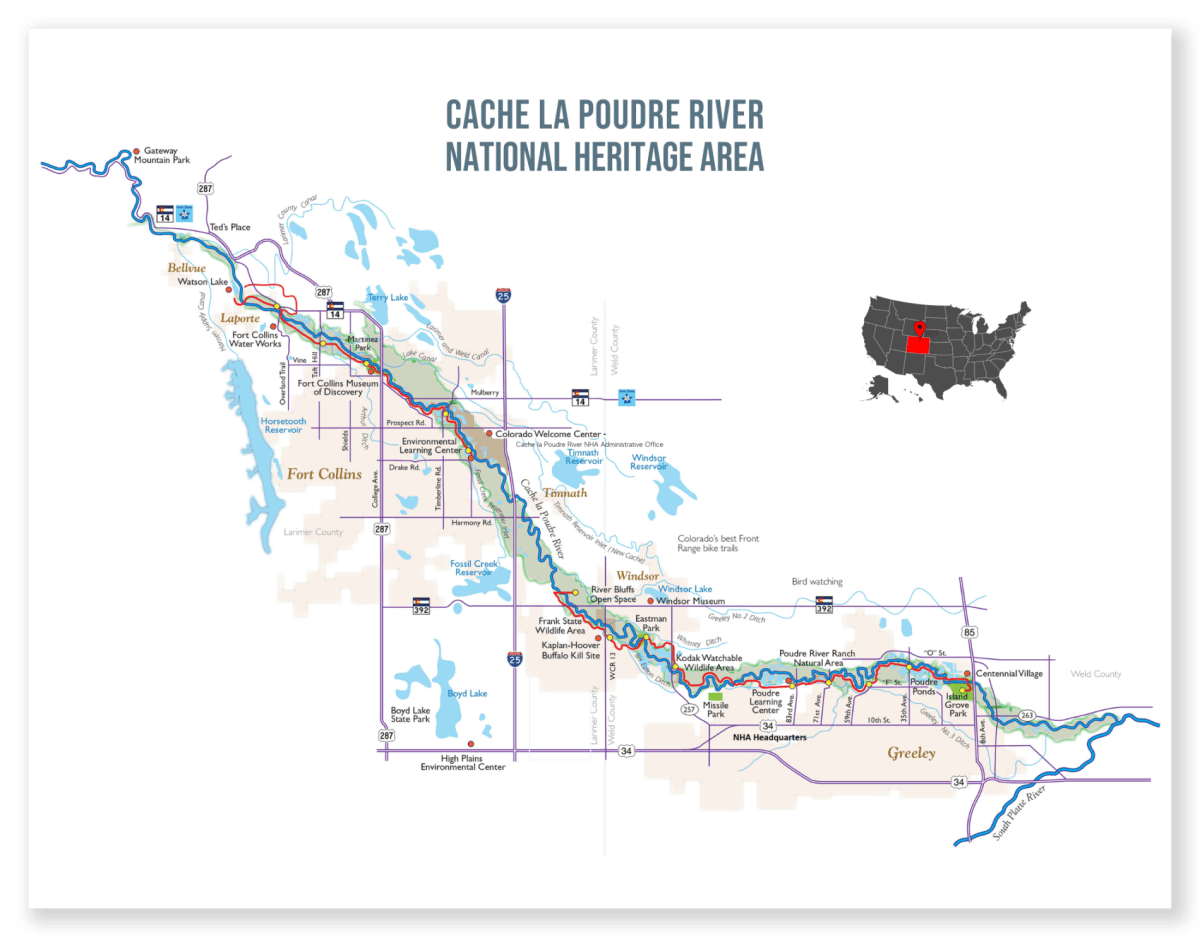
The Cache la Poudre River National Heritage Area (Cache NHA) is a 45-mile corridor along the river's 100-year floodplain, stretching from the foothills of the Rockies near Fort Collins to its confluence with the South Platte River in Greeley. Designated by Congress in 2009, the area adds to the greater U.S. history by honoring the region's role in the development of Western water law, innovative irrigation techniques, and water measurement devices. The Cache la Poudre River National Heritage Area (Cache NHA), managed by the Poudre Heritage Alliance nonprofit, strives to promote various historical and cultural opportunities, engage visitors and residents in the river corridor, and inspire learning, preservation and stewardship.
Website
poudreheritage.orgContact
+1 970-999-2433
Hours
- Monday: 8:00 AM – 4:00 PM
- Tuesday: 8:00 AM – 4:00 PM
- Wednesday: 8:00 AM – 4:00 PM
- Thursday: 8:00 AM – 4:00 PM
- Friday: Closed
- Saturday: Closed
- Sunday: Closed